PALUS
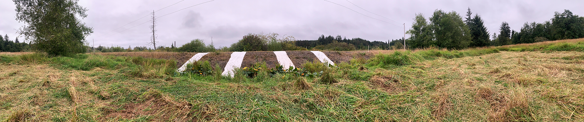
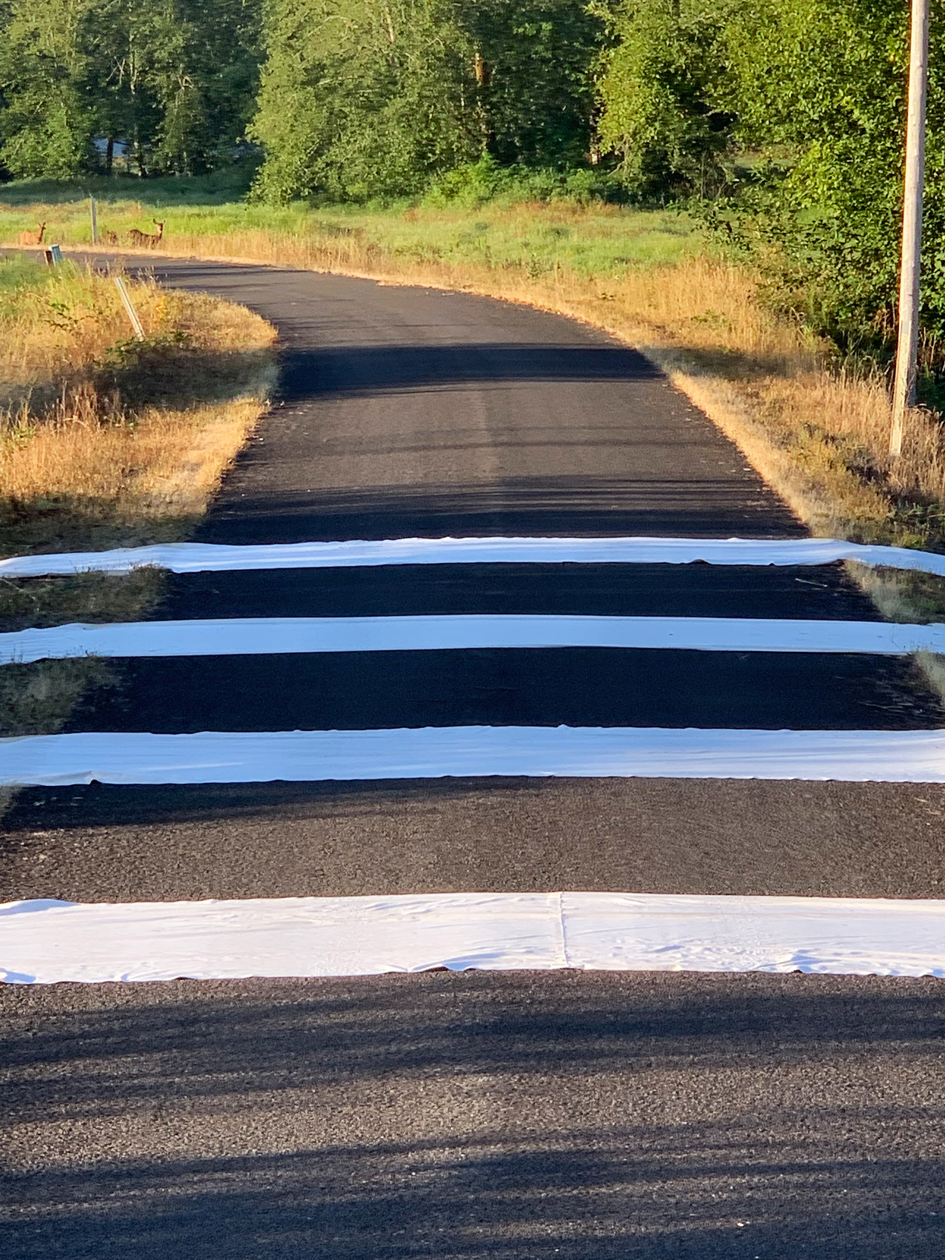
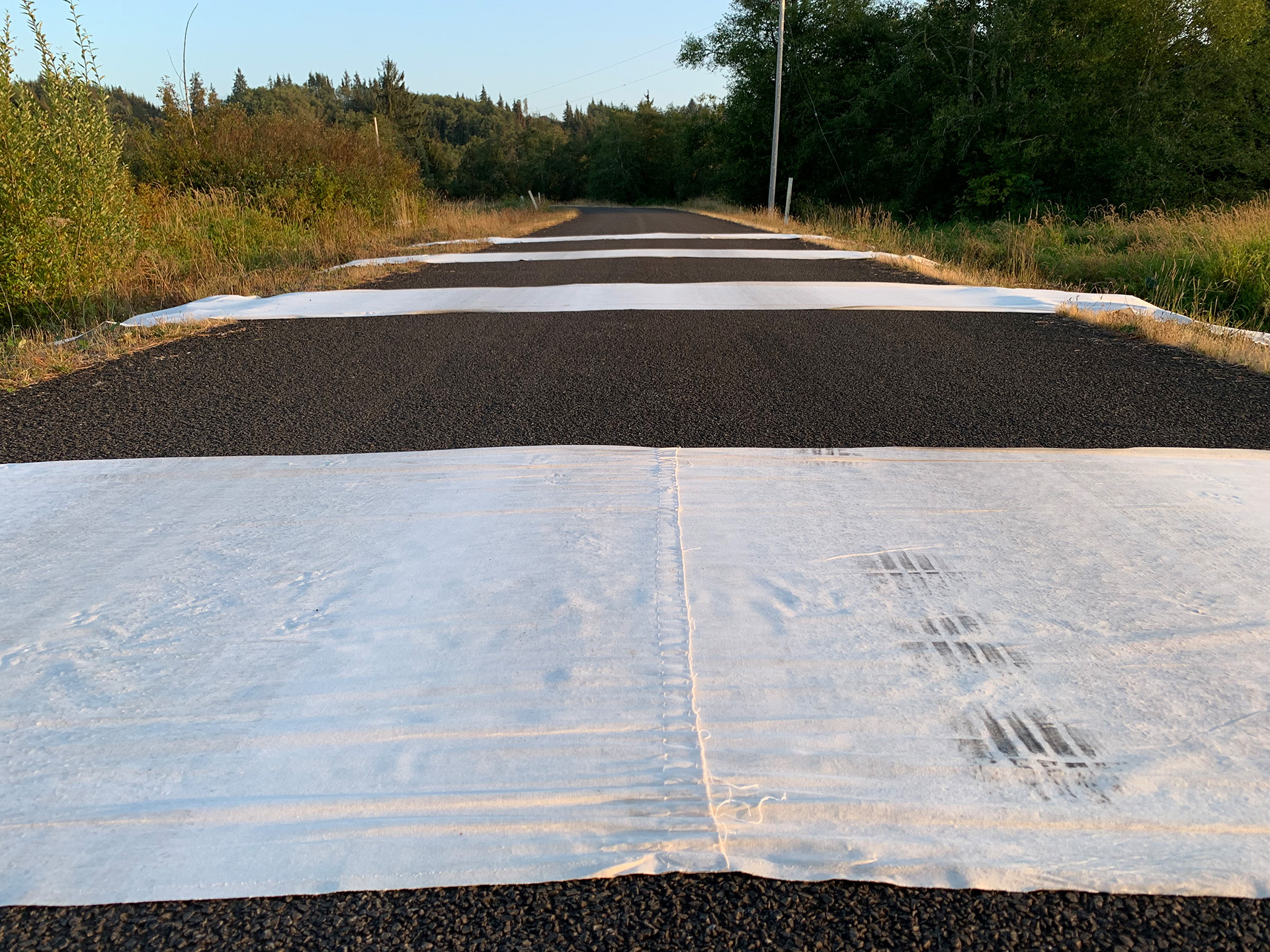
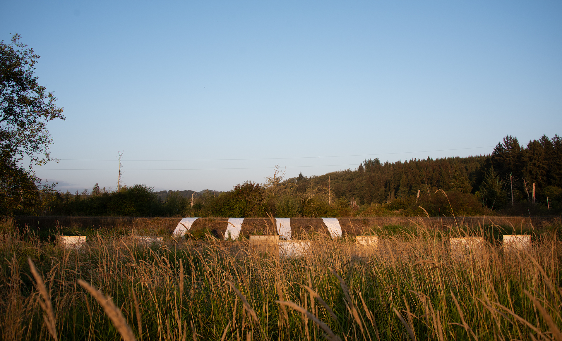
Boundary Ribbons
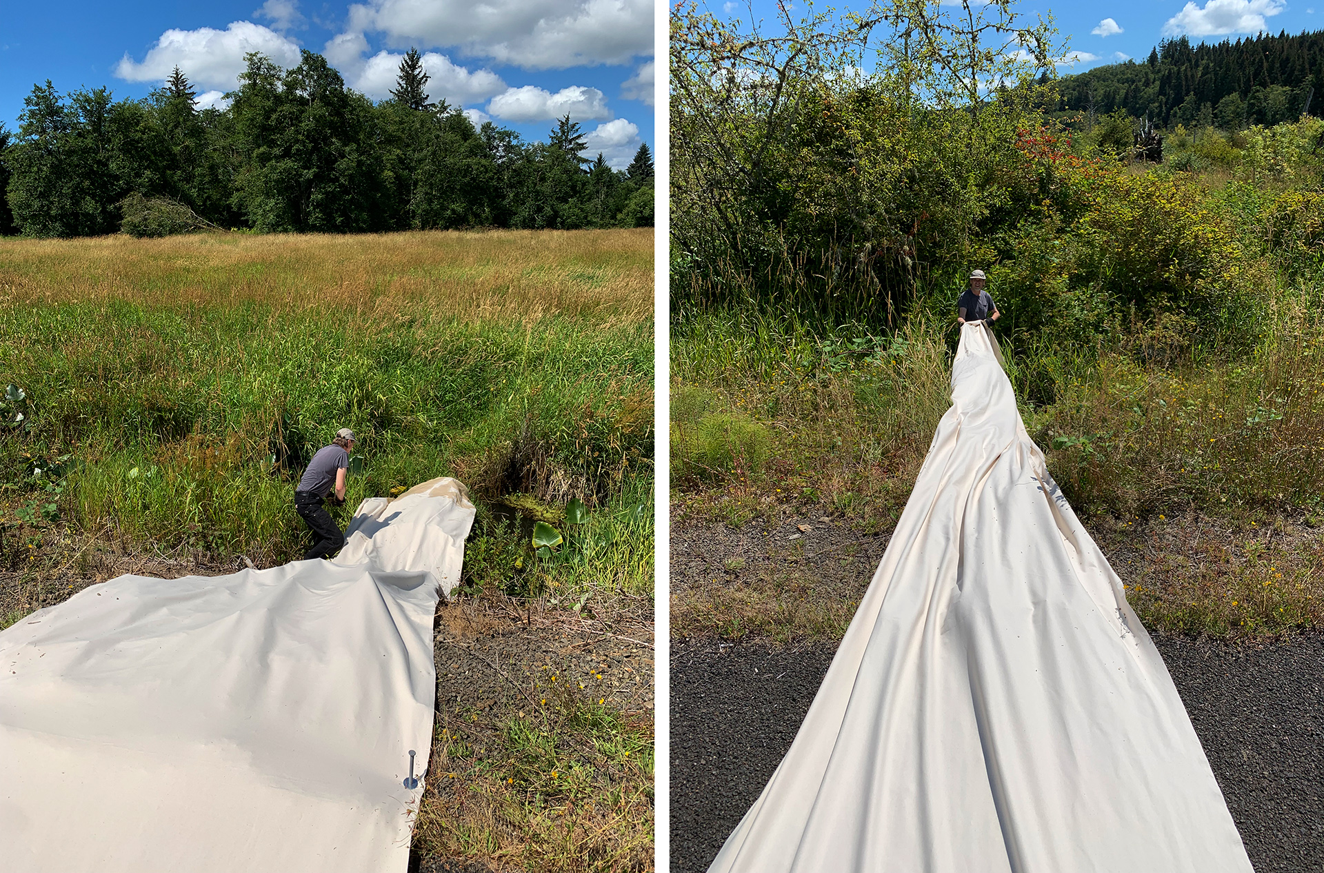
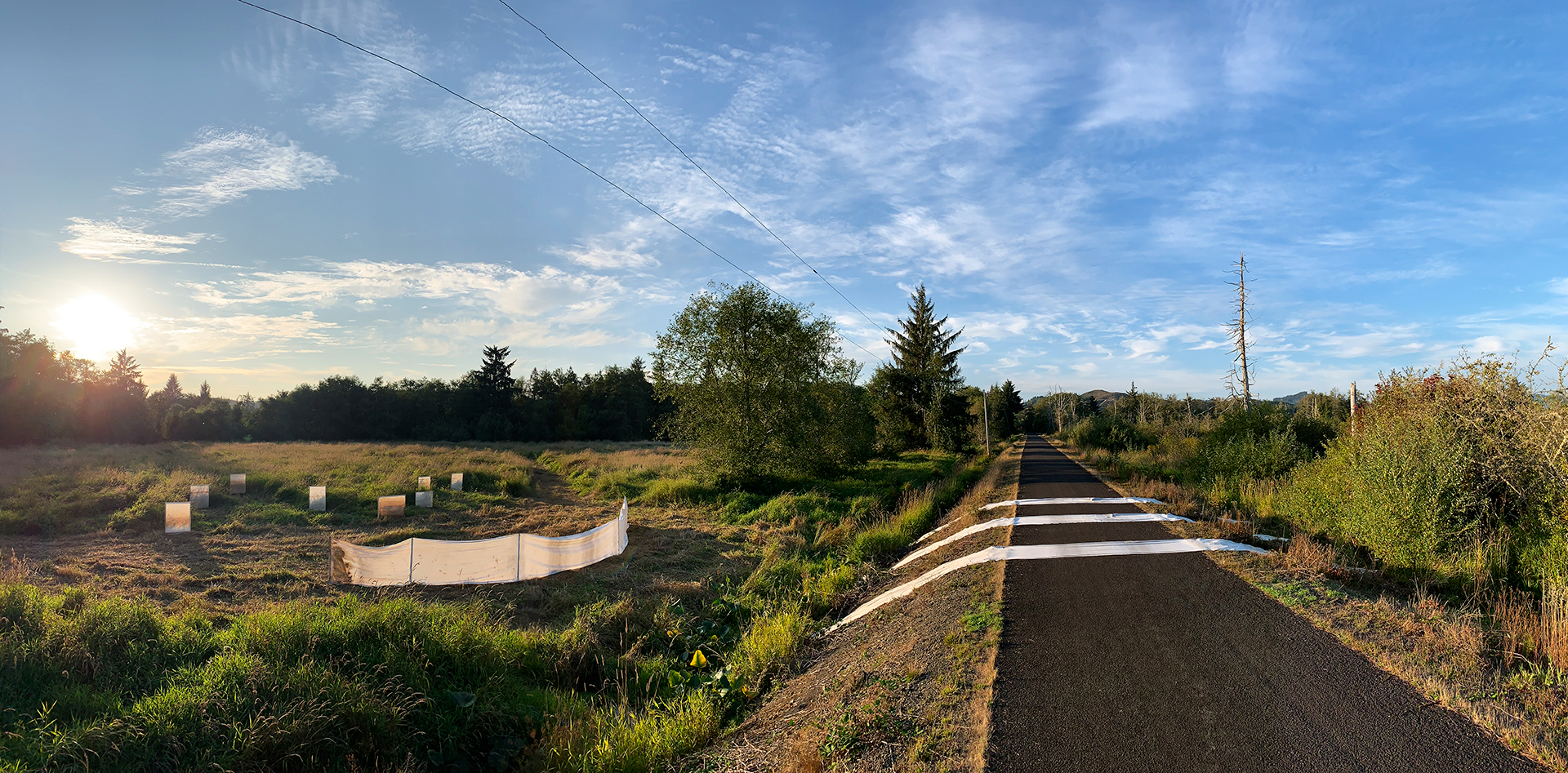
Draped across the dike road, 5’ wide x 60’ long strips of canvas stitch together swamp on one side and pasture on the other. Vehicles, people and wildlife leave their traces, and the waters in the ditch and swamp wick up at each end.
The ribbons evoke free flowing water as it breaches the levee and returns to the river’s historic surge plain.
Pasture/Swamp Screens
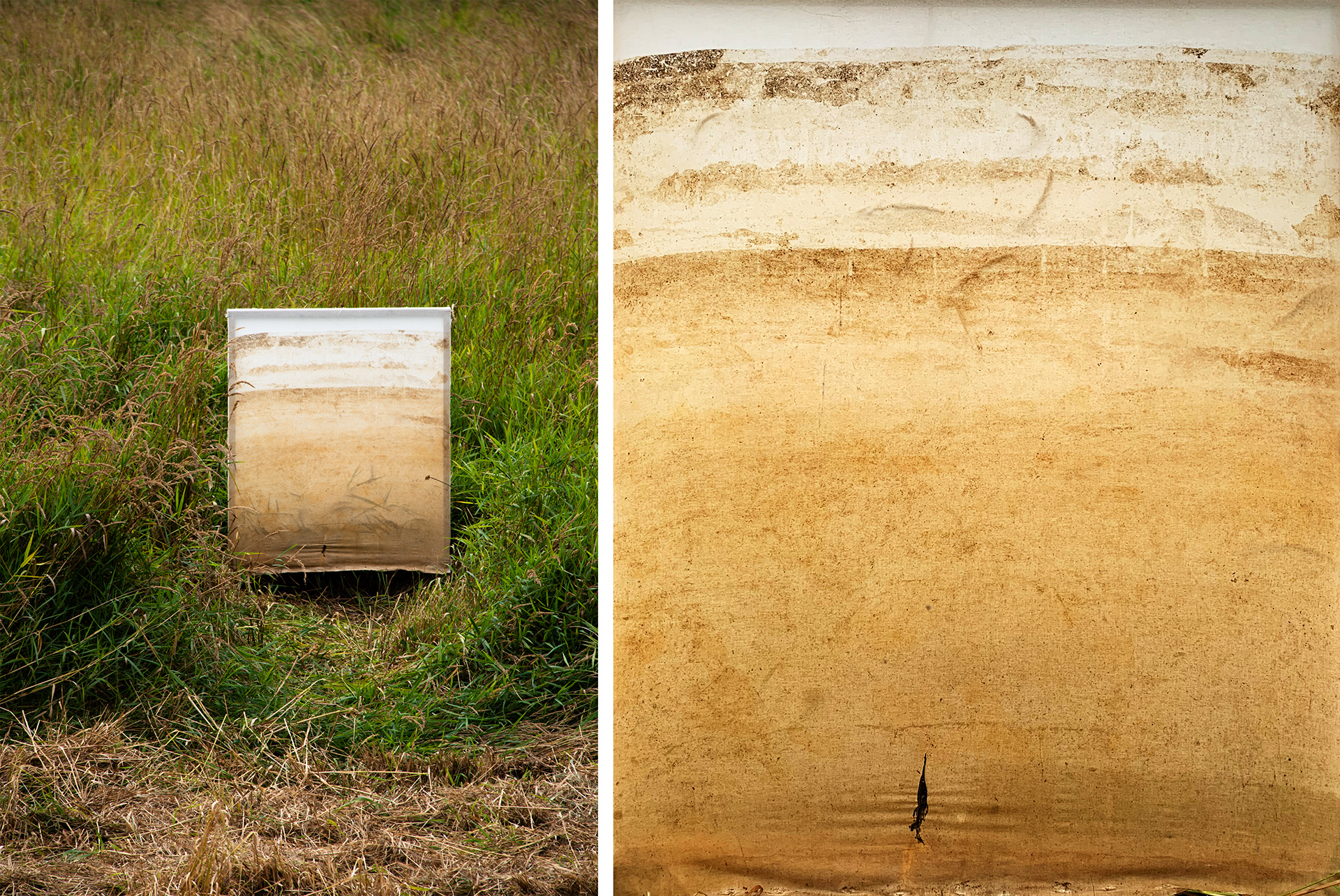
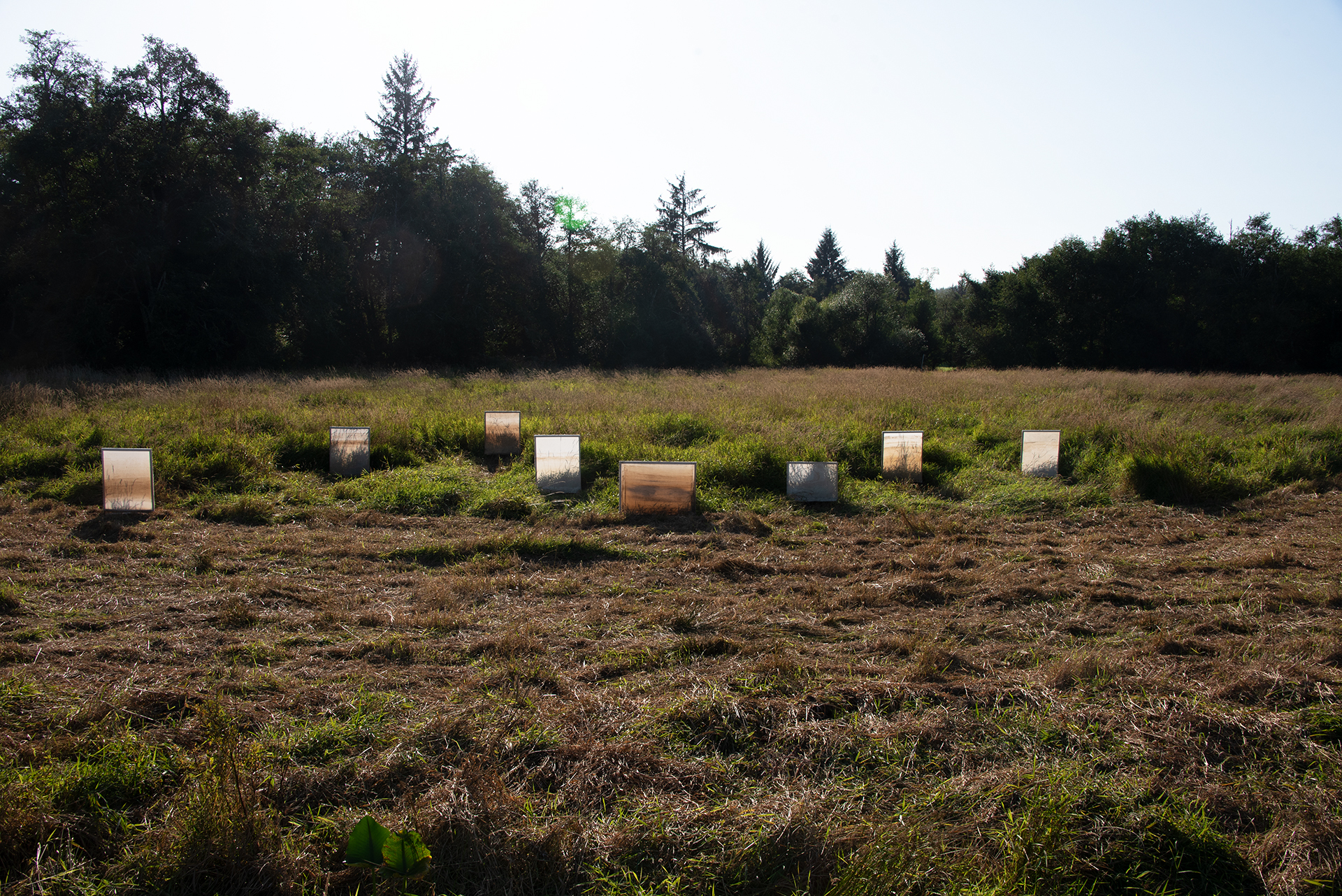
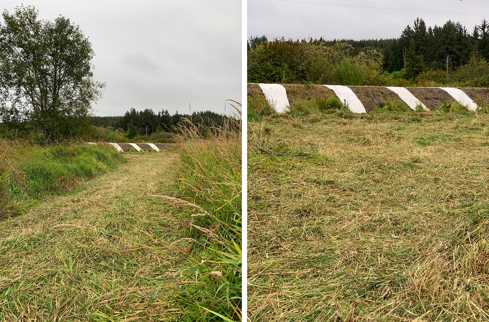
After months of replacing the swamp-stained canvases in the Torii tidal structure, we mounted 8 screens in simple frames and temporarily installed them on the pasture side of the dike.
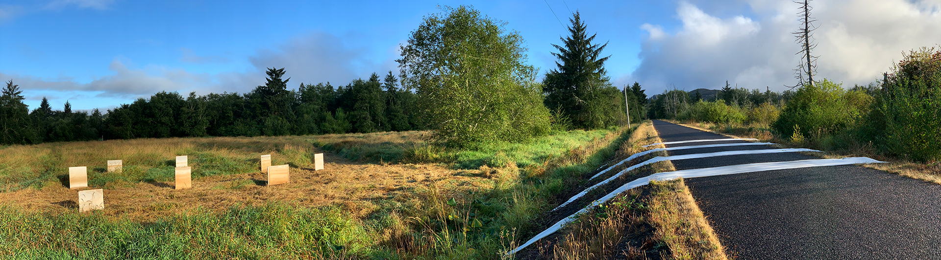
Arranged in an undulating line, the grouping faces and dialogues with the Boundary Ribbons as well as the swamp beyond.
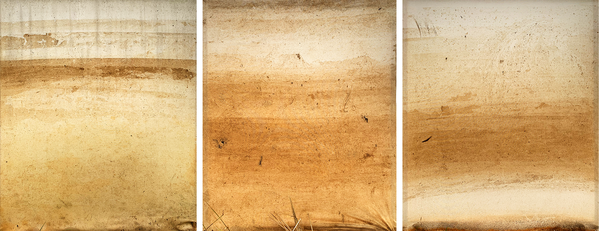
Marking tide levels in a would-be surge plain, the screens’ collective palimpsest of layered indexing likewise chronicles half a year of flowing time.

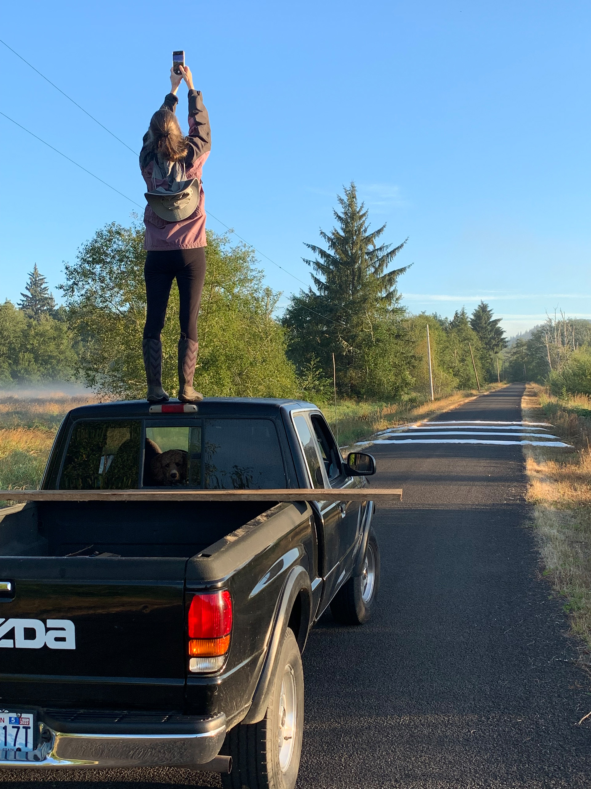
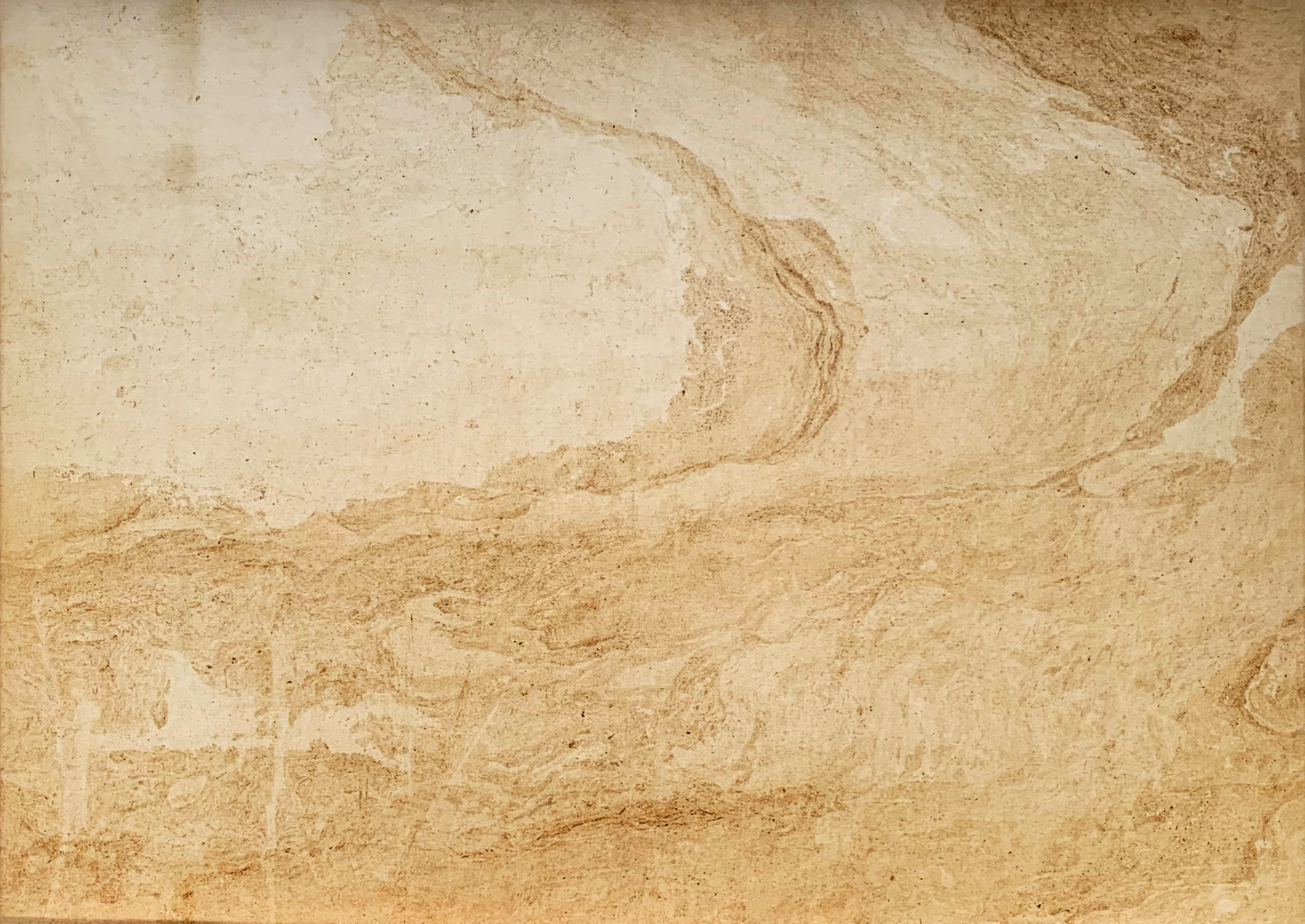
Finally, we pulled one Boundary Ribbon from the levee and placed it upright in the pasture to see its full complement of markings.
Acknowledgements and Gratitude
The locale rests on the unceded lands of the The Chinook Nation. What we now call Gray’s River and Wahkiakum County are the ancestral lands of the the five westernmost Tribes of Chinookan peoples: the Lower Chinook, Clatsop, Willapa, Wahkiakum, Kathlamet and many other Tribes who made their homes along the lower Columbia River. We acknowledge that we are on this land because of the forced removal of its traditional peoples by colonists and settlers. As settlers and/or guests, we recognize the strong and diverse Native communities in our region today, from Tribes both local and distant, and offer respect and gratitude for their stewardship of these lands—past, present and future.
We also especially thank Julia Prudhomme, Greta Hamilton, and all the staff at Oxygen Art Centre, Columbia Land Trust, Jim Sanderson, Peter and Janice Marcynzsyn, Genevieve Robertson, Rachel Rosenfield Lafo, Andrew Emlen and Robert Michael Pyle.
